Reno’s Truckee Meadows is bracing for a stretch of frost‑prone weather early next week. While snow has yet to arrive, clear skies and dropping nighttime temperatures are setting the stage for frost formation on surfaces ranging from car windshields to garden plants.
How frost forms in the Reno area
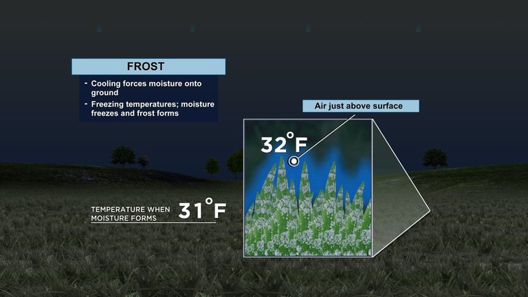
Frost requires two key ingredients: moisture in the air and temperatures at or below the freezing point. When the air cools enough to reach the dew point, water vapor condenses into tiny droplets. If the temperature continues to fall below 32°F (0°C), those droplets freeze, creating a layer of ice known as frost.
There are two primary types of frost that locals may notice:
- Frozen dew – water droplets that freeze directly on surfaces as the temperature drops.
- Depositional frost – water vapor that changes straight from a gas to a solid, bypassing the liquid stage. This type often looks like a thin blanket of snow.
Both types can appear on roofs, car windshields, and even on the ground, though the ground may stay frost‑free if it stays just above freezing while the air above it cools.
What the forecast shows
Forecasters expect nighttime lows to start around 37°F on Thursday, then dip further as skies clear. By Friday morning, temperatures could reach the dew point of roughly 35°F, allowing moisture to settle and freeze. The coldest readings are projected for Saturday and Sunday, with lows potentially sliding into the mid‑20s.
Because a low dew point makes it harder for frost to develop, the amount of moisture in the air will be a deciding factor. Reno often experiences dry air in the winter, which can limit frost formation despite sub‑freezing temperatures. However, recent humidity readings suggest enough moisture is present for frost to appear, especially on exposed surfaces.
Practical tips for Reno homeowners
Frost can be a nuisance for drivers and gardeners alike. Here are a few simple steps to mitigate its impact:
- Protect windshields – Cover your car or use a frost‑proof windshield cover to reduce scraping effort.
- Cover delicate plants – Use blankets or frost cloths on garden beds to shield seedlings from freezing damage.
- Check outdoor pipes – Insulate exposed water lines to prevent freezing and potential bursts.
- Monitor local forecasts – Stay updated on nightly temperature trends to plan outdoor activities accordingly.
Looking ahead
Temperatures are expected to rise on Thursday as a weak warm front moves in, reducing the likelihood of frost that evening. However, clear skies will return over the weekend, bringing another round of cold mornings. Residents should stay prepared for frost through Monday morning, when the next significant warming trend is forecast.
By understanding how frost forms and taking a few precautionary steps, Reno families can keep their vehicles, homes, and gardens safe during these chilly early‑winter nights.
Original reporting: 2news.com — read the source article.