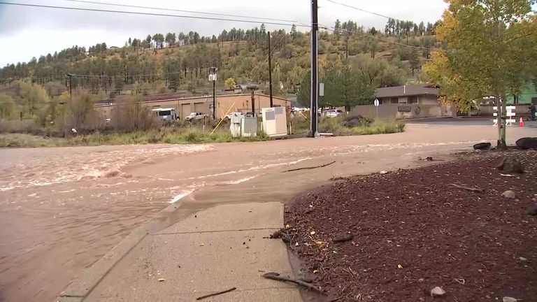
Arizona is experiencing a markedly wetter fall than usual, a trend that forecasters attribute to a powerful El Niño coupled with unusually active East Pacific hurricanes. The state’s Family First Alert team has issued three First Alert Weather Days for the coming week, warning residents to expect continued rain through the Halloween weekend.
How El Niño and weak trade winds are shaping the weather
El Niño develops when weak trade winds allow warm water to linger in the eastern Pacific instead of being pushed westward. This warm water fuels stronger tropical storms and hurricanes, which in turn channel moisture northward toward the Southwest. In a typical year, stronger trade winds would disperse the warm water, limiting the intensity and lifespan of Pacific storms.
Because the trade winds have been unusually weak this season, hurricanes have been able to survive longer and grow larger. The result has been a surge in tropical activity, including back‑to‑back storms Rachel and Polo, both of which delivered significant moisture to Arizona in October.
Measuring the storm power: Accumulated Cyclone Energy
Scientists track the strength of tropical systems with the Accumulated Cyclone Energy (ACE) index. With the current strong El Niño, the ACE number for the East Pacific has reached 242—a stark contrast to the 21 recorded during the robust La Niña of 2021, the opposite climate pattern.
Higher ACE values indicate longer‑lasting, more energetic hurricanes that can transport greater amounts of water vapor into the interior of the continent. This explains why Arizona has seen a series of heavy downpours, flash floods, and even tornadoes in recent months.
Recent impacts across the state
Since August, Arizona has endured a series of severe weather events. Floodwaters swept through Bisbee, while a flash flood in the Grand Canyon claimed three hikers’ lives. September storms prompted water rescues north of the Phoenix Valley, and October brought additional thunderstorms, hail, and two EF‑1 tornadoes that touched down in Prescott and Heber‑Overgaard.
Flash flooding in Oak Creek Canyon left a bridge underwater and stranded dozens of hikers, and a separate incident near Sedona required the rescue of four people after their SUV was swept away. In the historic mining town of Clifton, floodwaters and rockslides caused significant damage, and residents of the Valley described a hailstorm that turned streets into a “war zone.”
Historical roots of the El Niño name
The term “El Niño” – Spanish for “the Christ child” – dates back to Peruvian fishermen who first noticed a pattern of warm water replacing the cold, nutrient‑rich currents that supported their anchovy catches. Warm water reduces phytoplankton, the base of the marine food chain, leading to lower fish populations. Overfishing compounded the problem, but the clear link between warmer ocean temperatures, cloudy skies, and humid conditions was enough for fishermen to label the phenomenon after the infant Jesus, a nod to the Christmas season in the Southern Hemisphere.
What’s next for Arizona?
Forecasters expect the wet pattern to persist through the end of October and into early November, with additional rain likely as the El Niño remains in place. Residents are urged to stay alert, heed local weather warnings, and prepare for possible flash‑flood conditions, especially in canyon areas and low‑lying washes.
While the increased precipitation has caused disruptions, it also offers a reprieve from the severe drought that has plagued the region for years. The added moisture may help replenish reservoirs and improve soil moisture for the upcoming planting season, a potential benefit for Arizona’s agricultural communities.
Original reporting: azfamily KTVK/KPHO Phoenix (news) — read the source article.