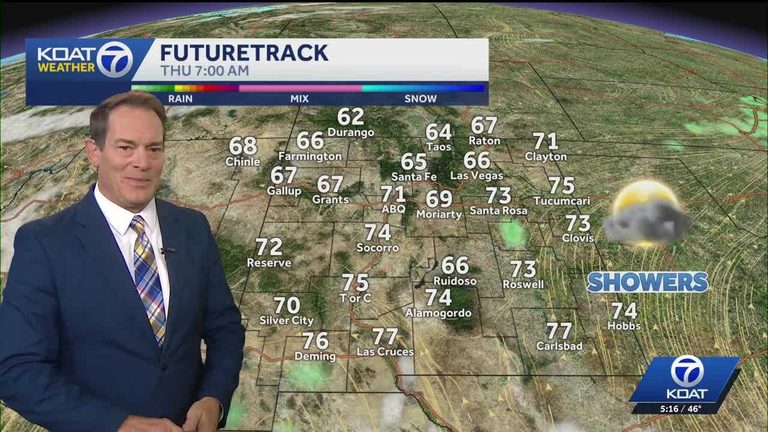
New Mexico is experiencing a brief spell of quiet weather, with mostly clear skies and pleasant fall temperatures across the state. Aside from a few isolated storms in far‑southeast New Mexico near Carlsbad early this morning, the atmosphere remains calm with only scattered patches of fog.
Today’s Outlook
Afternoon sunshine will dominate, bringing temperatures in the 60s statewide and warmer pockets in the southern region reaching the 70s. A possible thundershower may redevelop later today over the far southeast near Carlsbad, but that is the only area with a chance of evening rain.
Wednesday
Wednesday will mirror today’s pattern, offering quiet, sun‑filled skies and comfortable fall temperatures across almost the entire state. The southeast will still need to monitor for a handful of mainly afternoon thundershowers.
Thursday and Friday
Thursday introduces a higher rain probability, especially in southern New Mexico, as Tropical Storm Vance makes landfall in western Mexico. Moisture surging northward ahead of the storm raises the threat of heavy rainfall for the southern part of the state late Thursday, with a significant moisture surge expected into southeast New Mexico and west Texas early Friday morning.
Later Friday and Saturday, rain chances become more scattered to isolated as the region awaits a stronger wind‑driven storm moving in off the Pacific for the weekend.
Weekend Outlook
Sunday looks to be the wetter day, particularly during the afternoon and evening hours. Monday, on the storm’s backside, may bring stronger winds, cooler temperatures, and continued rain chances for the northeast corner of the state. Higher terrain in central and northern New Mexico, as well as southern Colorado, could see mountain snow from this system.
Original reporting: KOAT Albuquerque — read the source article.