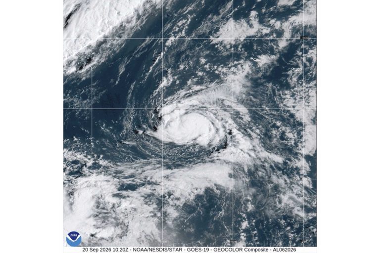
The National Hurricane Center in Miami reported that a new tropical storm, named Fay, formed Sunday in the northern Atlantic Ocean. At its peak, Fay recorded maximum sustained winds of 65 mph (100 kph) and was positioned about 405 miles (650 kilometers) southwest of the Azores. No coastal watches or warnings have been issued, and forecasters expect the system to lose strength and dissipate by the end of the week.
Current status of Tropical Storm Fay
Earlier Sunday morning, Fay’s winds were measured at 45 mph (75 kph) at 5 a.m. EDT. The storm is moving north‑northeast at roughly 5 mph (7 kph). While the system is currently organized enough to be classified as a tropical storm, the center is expected to weaken as it moves farther from the Azores, an autonomous region of Portugal located about 800 miles (1,287 kilometers) off mainland Portugal.
Tropical Storm Odalys gaining strength
In the Pacific, another system, Tropical Storm Odalys, has formed southwest of Mexico’s west coast. The storm is currently about 1,345 miles (2,160 kilometers) west‑southwest of the southern tip of Baja California and is moving west‑northwest at 10 mph (17 kph). Odalys carries maximum sustained winds of 50 mph (85 kph) and is showing signs of better organization. Meteorologists anticipate that the storm could intensify into a hurricane within the next day or so.
Like Fay, Odalys has no coastal watches or warnings in effect at this time. Residents along Mexico’s western shoreline are being advised to stay informed as the system approaches, though the storm remains far offshore.
What the forecasts mean for the upcoming hurricane season
Fay is the first tropical storm of the 2026 Atlantic hurricane season, and its early formation underscores the importance of continued vigilance as the season progresses. While Fay is not expected to threaten land, its development serves as a reminder that the Atlantic basin remains active. Meanwhile, Odalys adds to the Pacific basin’s activity, highlighting the need for coordinated monitoring across both oceanic regions.
Both storms illustrate the ongoing work of the National Hurricane Center and its partners in tracking and forecasting tropical systems. The agency continues to provide regular updates, satellite imagery, and model guidance to help the public and emergency managers prepare for any potential impacts.
Residents in the Atlantic and Pacific coastal areas are encouraged to follow official updates, review personal emergency plans, and ensure that supplies such as food, water, and medication are readily available. While neither Fay nor Odalys currently poses a direct threat, the dynamic nature of tropical weather means conditions can change rapidly.
Original reporting: 40/29 / KHBS (NW Arkansas) — read the source article.