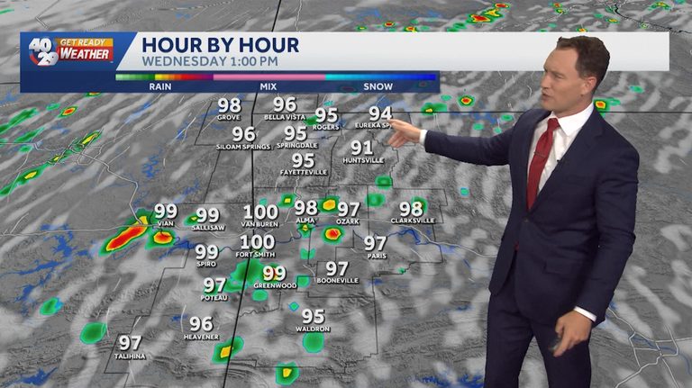
Fayetteville, Ark. – The 40/29 Get Ready Weather Team is alerting the community that Wednesday will bring a mix of brief showers and isolated storms. Chief Meteorologist Darby Bybee explained that the weather pattern is expected to be inconsistent, with periods of sunshine interspersed with rain and thunder.
What to expect
Bybee described the conditions as “hit‑and‑miss,” meaning that precipitation will not be continuous across the region. Some neighborhoods may see only a few light showers, while others could experience brief, more intense thunderstorms. The timing of these events is uncertain, so residents should stay prepared throughout the day.
Tools to stay informed
The 40/29 News website offers a 7‑day forecast for Northwest Arkansas and the River Valley, allowing viewers to see how the weather may evolve over the coming week. An interactive radar map is also available, providing real‑time tracking of rain cells and storm movement. Live skycams give a visual snapshot of current conditions across Fayetteville and surrounding areas.
Safety recommendations
When thunderstorms are possible, the National Weather Service advises the following precautions:
- Secure outdoor items that could become projectiles in strong winds.
- Avoid standing under trees or near metal structures during lightning.
- Stay informed of any severe weather watches or warnings issued for the area.
- If you are driving, reduce speed and increase following distance, as wet roads can be slick.
For families, it is a good time to review emergency plans and ensure that flashlights, batteries and a basic first‑aid kit are readily accessible.
Stay connected
The 40/29 Get Ready Weather Team, which includes meteorologists Laura Huckabee, Drake Foley and Cole Makos, encourages viewers to subscribe to the station’s YouTube channel for the latest weather updates and to download the free 40/29 News app. The app provides push notifications for severe weather alerts, helping residents stay safe and informed.
Looking ahead
While Wednesday’s weather will be variable, the broader forecast for the week suggests a gradual return to drier conditions later in the week. Residents can continue to monitor the 7‑day outlook and radar for the most accurate, up‑to‑date information.
For any immediate concerns or to report hazardous conditions, contact the local National Weather Service office or the Fayetteville emergency management office.
Original reporting: 40/29 / KHBS (NW Arkansas) — read the source article.