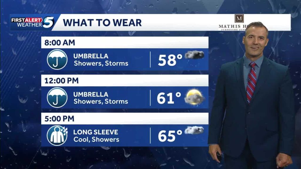
KOCO 5 Meteorologist Jonathan Conder is warning viewers to expect waves of rain across the area today, with pockets that could turn into heavy storms capable of quick flooding and gusty winds. This article breaks down what to watch for, how conditions could evolve, and practical steps you can take to stay safe and minimize surprises.
Jonathan Conder’s forecast paints a picture of intermittent bands of rain rolling through, not a single, steady storm. That pattern means some neighborhoods will get dumped on while others just see a steady drizzle, so don’t assume your block will match your neighbor’s weather. Timing will be spotty, and that makes keeping an eye on short-term updates important.
The potential for heavy storms is real in a few of these bands, which brings a risk of sudden downpours and localized flooding. Urban areas with lots of pavement and poor drainage are especially vulnerable to quick rises in water on streets and in low-lying yards. Even short bursts of heavy rain can strand vehicles and create hazardous driving conditions in a matter of minutes.
Beyond water, gusty winds often tag along with these stronger cells, and that can mean falling branches and scattered outages. If you live near trees or have loose outdoor items, securing them ahead of time reduces the chance of damage. Power companies usually respond fast, but your best bet is to prepare for short interruptions just in case.
For drivers, visibility will fluctuate as storms pass through, and hydroplaning becomes a real concern on slick roads. Slow down, give extra space between cars, and avoid flooded stretches entirely—depth is deceptive and engines stall fast. If you encounter standing water on a road, turn around rather than risk driving through it.
Homeowners should pay attention to gutters, downspouts, and sump pumps; a little prep can prevent big headaches. Clear any debris that could block water flow and make sure drains are directing water away from foundations. If you live in a flood-prone spot, relocate valuables to higher ground and have sandbags or barriers ready where practical.
Keep your phone charged and alerts on, because these banded rain setups change fast and forecasts get refined hourly. KOCO 5 will update the timeline and pinpoint the tougher cells as the day goes on, and watching radar can give you a heads-up when a heavy band is approaching. Localized forecasts matter more than broad-brush predictions in this kind of pattern.
Remember, personal readiness beats panic. Simple moves—parking on higher ground, stashing emergency supplies, and avoiding unnecessary travel during the heaviest periods—cut the risk significantly. Follow updates from Jonathan Conder and your local news, and treat any sudden heavy downpour with respect; a few minutes of caution can keep you and your family out of harm’s way.


