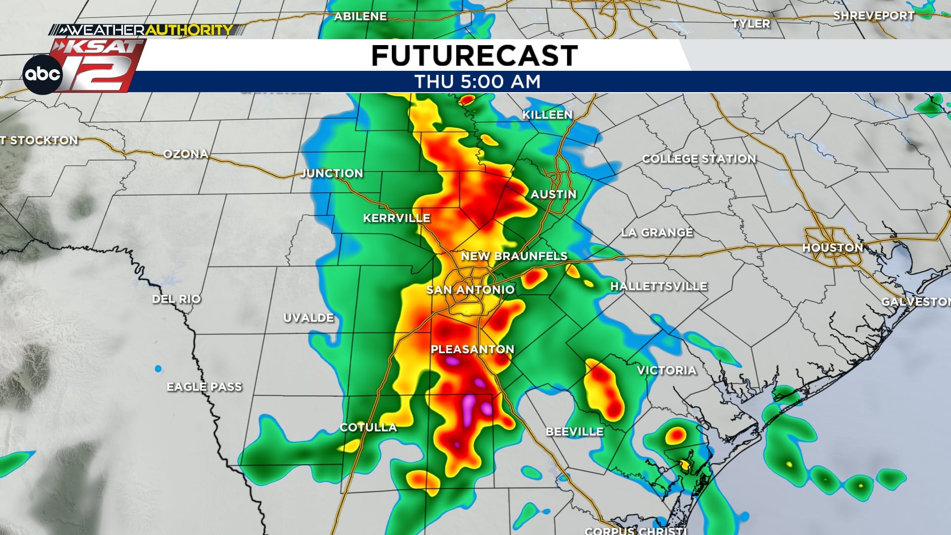
Storms that rolled through the San Antonio area overnight left hefty rain in their wake and we’re tracking more rounds into Thursday and into Memorial Day weekend. Expect the heaviest impacts along and west of the city, including the Rio Grande corridor and the Edwards Plateau, with street flooding as the main concern. If you’ve got Spurs watch parties or holiday plans, keep a weather eye on timing and travel routes.
Recent downpours dumped roughly three quarters to two inches of rain across pockets of the area, which means roads and low spots are already saturated. That sets us up for more heavy rainfall if storms redevelop, and multiple rounds this week raise the flood potential. This pattern will linger into at least the start of next week, so don’t treat today as the end of the threat.
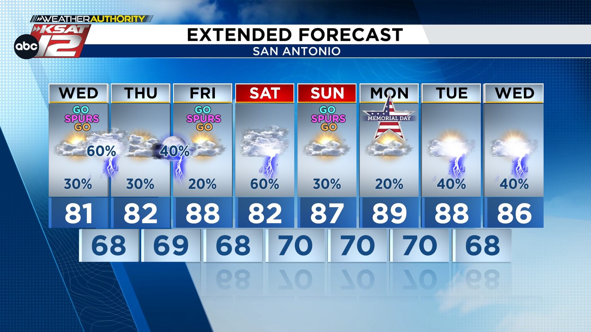
Most of Thursday should feel calmer than last night, but a stray storm can pop up — there’s still about a 20 percent chance for isolated activity this evening. If you’re heading to outdoor Spurs watch parties, bring a rain plan and consider parking on higher ground. The higher threat for stronger cells is focused along the Rio Grande and out into the Edwards Plateau where storms can tap more instability.
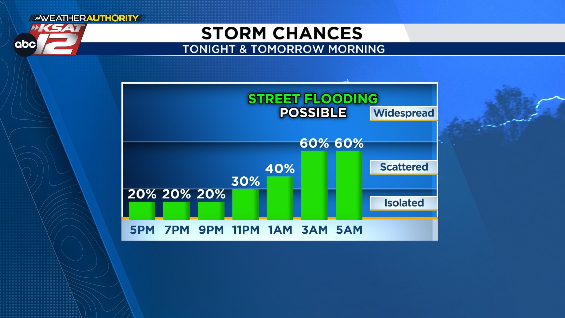
Storms forming to our west overnight could sweep through the metro area and bring heavy downpours in a short time span. With saturated roads, that kind of bursty rain is the primary flashpoint for street and low-water crossing flooding. There’s comparatively less concern for large hail or widespread damaging winds in this particular setup, yet localized gusts are still possible.
The overnight activity should march out toward sunrise, but timing can vary by a few hours depending on how storms evolve. That means it’s smart to check the forecast before your morning commute and leave a bit earlier if roads look wet. Thunder overnight can wake children, pets, or adults, so consider moving vehicles out of low-lying spots and keeping an eye on yard and driveway drainage tonight.
Friday looks to be the quietest day in the short term, but the pattern swings back Saturday with another round of showers and storms possible. Because we’ve already seen multiple rounds of rain this week, any new heavy cell could cause rapid rises in creeks and streets. Temperatures may stay a bit cooler with clouds and rain around, so outdoor plans might feel dampened and chilly.
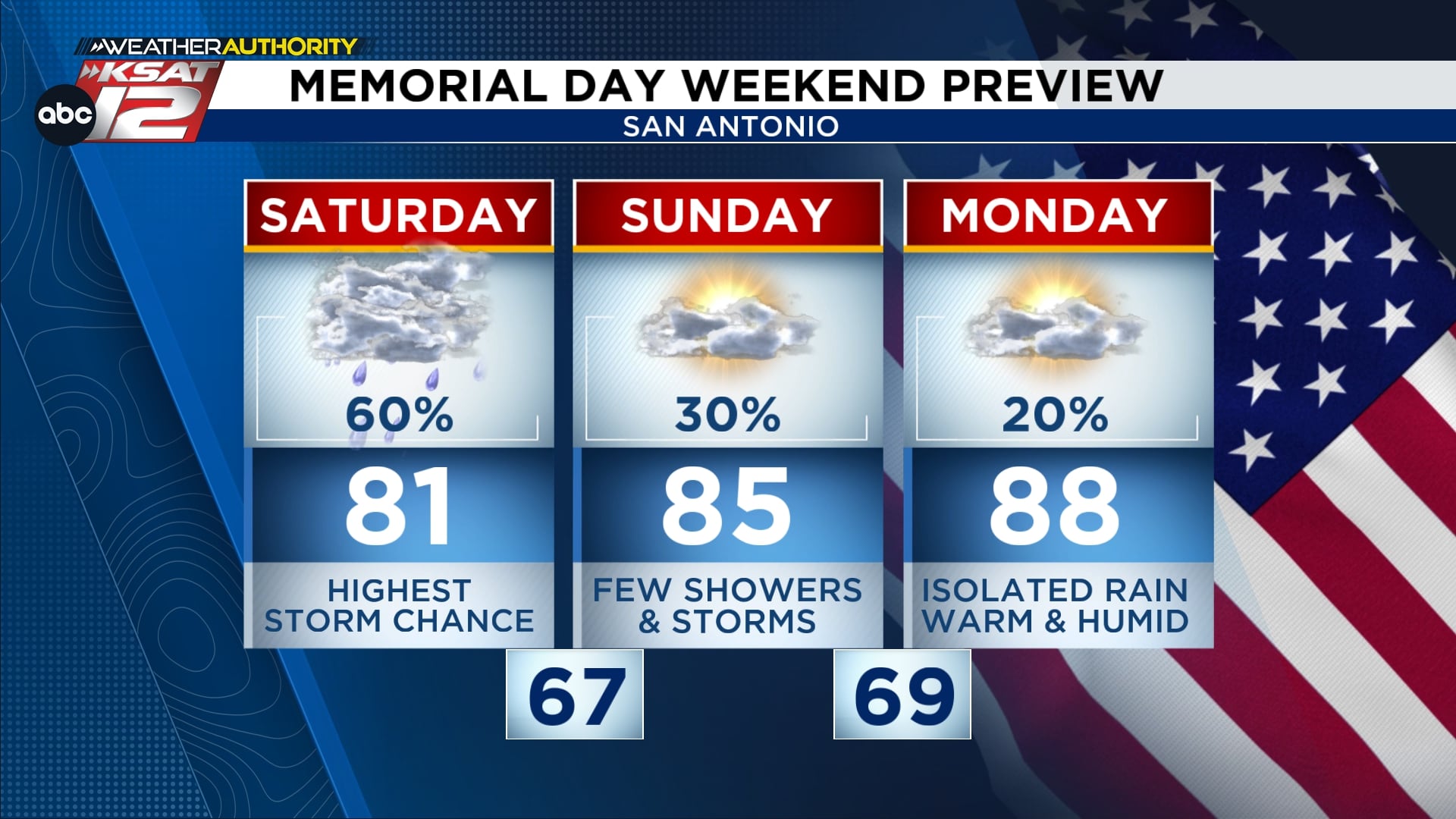
Not everything this weekend is a washout. Sunday and Memorial Day currently look to offer the best windows for dry weather and some sun, though isolated showers can’t be ruled out. If you’re planning gatherings, aim for those drier windows and have a quick backup spot for short notice moves indoors. Keep checking updates because the odds of widespread rainfall drop by Sunday, improving chances for outdoor time.
Looking ahead, the overall weather pattern stays active and hints at the return of rain early next week as fronts and disturbances wander back through the region. That keeps us on alert for renewed shower and storm chances, so don’t stash your rain gear just yet. For now, the key message is simple: expect more rounds of rain, plan around the timing, and respect flood-prone spots when you drive.
Quick weather resources
- WATCH LIVE: Doppler Radar
- Hourly and 10-Day Forecast
- Download FREE Weather Authority App: Up-to-date forecast information and livestreams from trusted local meteorologists.
- Share weather photos and tips