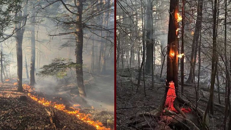
The Maine Forest Service confirmed that a downed power line ignited a wildfire on the popular Bucks Ledge hiking area in the town of Woodstock on Friday afternoon. The blaze quickly spread through hardwood leaf litter and mature timber on the mountain’s extremely steep terrain.
Dry conditions and rapid response
Because the region was experiencing an ongoing drought, vegetation was exceptionally dry and ready to burn. The Forest Service’s wildfire danger map had already flagged moderate fire danger for the Woodstock area on Friday, and low danger for Saturday.
Central Maine Power reported that the outage affected 37 customers along the roads surrounding North Pond, adjacent to Bucks Ledge. Power was restored to the affected area by 4:04 p.m.
Firefighting effort
Multiple fire departments from across Oxford County responded, joined by two Maine Forest Service rangers and a ranger‑piloted helicopter. The aerial unit conducted bucket drops, dumping water from above to knock down the flames. Video shared by local viewers showed the helicopter’s water drops in action.
Ranger Malcolm MacDonald noted that shifting winds on the steep slopes made initial containment challenging, and that “some of the trees we don’t typically see burning this time of year, the fire got into them and the leaves themselves have been very dry.”
Containment and aftermath
By Saturday morning, the fire was stopped at approximately 5.8 acres, and officials said there was no longer any threat to the public. Crews will remain on scene in the coming days to monitor and extinguish any remaining hot spots.
The Greenwood Fire and Rescue Department announced that the Locke Mills boat launch will stay closed until further notice while crews set up a water supply to support ongoing fire‑suppression efforts.
Community impact
While the blaze caused temporary road closures and a brief power outage, the swift, coordinated response prevented a larger disaster in a beloved recreation area. Residents are encouraged to stay informed through the Maine Forest Service’s wildfire danger map and to practice fire‑safe habits during the lingering drought season.
Original reporting: WMUR (Hearst) – local news — read the source article.