Residents of western Pennsylvania should prepare for a notable change in the weather pattern as the week progresses. Historically, the first measurable snowfall in the Pittsburgh region arrives in mid‑November, and forecasters are indicating that the season’s initial flakes could appear as early as late this week.
Thursday: Rain Showers Begin
Early Thursday morning will see the development of scattered rain showers that are expected to become more widespread throughout the day. Commuters should anticipate wetter road conditions, especially during the morning rush hour. Temperatures on Thursday will remain relatively mild, with highs ranging from the low 40s to the lower 50s Fahrenheit, providing a brief respite before the cold front arrives.
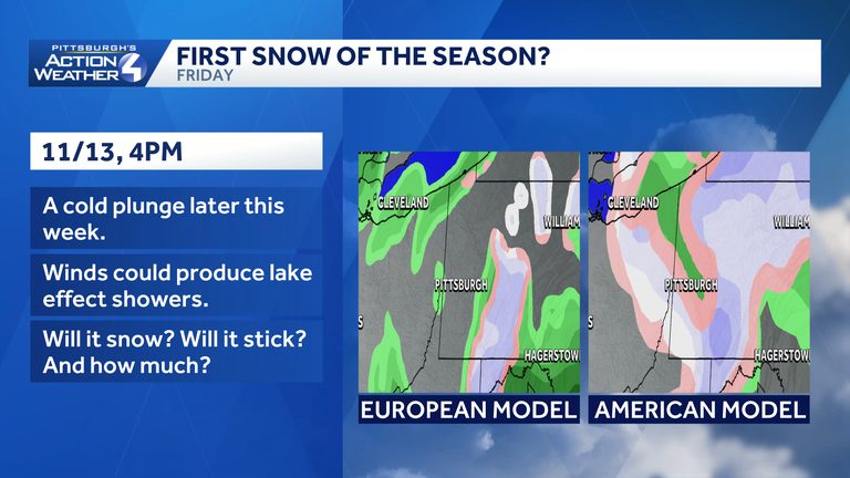
Friday: Cold Front Brings Potential Snow
As the potent cold front pushes into the region, temperatures are projected to dip into the 30s on Friday. If sufficient moisture remains in the atmosphere, a rain‑snow mix could develop during the morning hours. The Laurel Highlands, with its higher elevation, has a greater likelihood of seeing all‑snow conditions, and any accumulation that does fall may have a chance to stick to the ground.
Saturday Outlook
Saturday is expected to stay cold, keeping the possibility of additional snowflakes on the table. However, limited moisture and relatively warm ground temperatures could prevent significant accumulation. Residents should monitor updates from the Pittsburgh Action Weather team for the latest details as the situation evolves.
What This Means for Residents
While the forecast does not guarantee a heavy snowfall, the shift to wintry weather signals the start of the season’s coldest period. Drivers should exercise caution on potentially slick roads, and families may want to keep an eye on school district communications regarding any schedule adjustments. The forecast will be refined over the next few days, so staying informed through local weather updates is advisable.
Looking Ahead
Overall, the transition from mild, dry conditions to a colder, wetter pattern is typical for this time of year in western Pennsylvania. The first measurable snowfall historically occurs in mid‑November, and this week’s outlook suggests that the region could be on the cusp of that seasonal milestone. For the most accurate and timely information, continue to follow the Pittsburgh Action Weather team’s updates.
Original reporting: WTAE (Hearst) – local — read the source article.