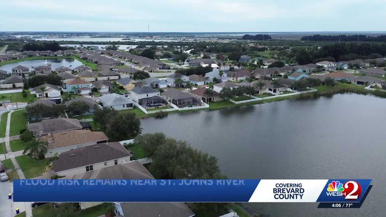
Parts of Brevard County – including Cocoa, Rockledge, Lake Washington and other communities along the St. Johns River – are being warned of potential flooding on Saturday. The river is expected to crest as high as 17 feet near Cocoa, a level that could overwhelm local drainage and cause water to back up onto streets and homes.
Why the water is rising
The threat stems from a combination of factors that local officials say are unprecedented. An extreme “once‑in‑1,000‑years” rain event has saturated the watershed, while unusually high king tides are pushing water upriver. At the same time, the region’s drainage systems are already operating at capacity, leaving little room for additional runoff.
Residents share their concerns
Long‑time Rockledge resident Heather Strain called the situation a “wake‑up call.” “If you don’t have flood insurance, that’s a huge expense,” she said, noting that she has been considering flood gates to protect her home’s doorways.
Strain also praised the area’s retention ponds and canals, saying they have helped keep water levels manageable so far. “We’ve been really lucky, but it may not always be that way,” she added.
Other locals are taking precautions as well. Markym Brown, whose parents also live in Rockledge, said the heavy rain is a familiar pattern. “Usually it fills up pretty good, then ends up dropping back down,” he explained, adding that in his 25 years in the area no one has yet been forced out of their home by floodwaters.
What officials recommend
County emergency management officials urge residents to review their flood insurance coverage, move valuables and vehicles to higher ground, and keep sandbags or other flood‑mitigation supplies on hand. Those living in low‑lying areas should monitor local alerts and be prepared to evacuate if water begins to encroach on their property.
Authorities also remind homeowners that flood insurance is separate from standard homeowners policies and can be purchased through the National Flood Insurance Program or private carriers.
Looking ahead
While the river’s crest is still being modeled, the combination of historic rainfall, high tides and already‑stressed drainage suggests that Saturday could see the most significant water rise of the season. Residents are encouraged to stay informed through local news outlets, the county’s emergency management website, and any alerts sent via text or email.
Community groups and churches in the area have already begun organizing assistance for anyone who may need help moving belongings or cleaning up after the water recedes. As the situation develops, the focus remains on protecting families, preserving property and ensuring that the county’s response remains swift and coordinated.
Original reporting: WESH Orlando — read the source article.