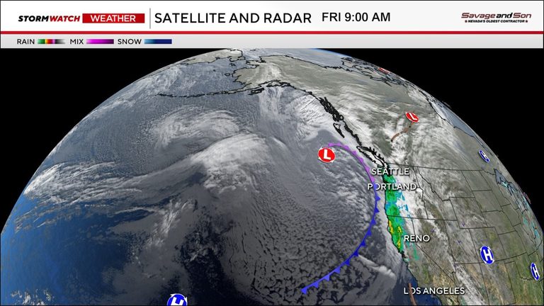
Reno residents should brace for a busy weather pattern as a strong storm moves through the region Friday afternoon and continues into early Saturday morning. A second system is expected late Sunday into Monday, followed by additional disturbances on Wednesday and Thursday. The combined effect will be a noticeable drop in temperatures and the potential for significant snowfall.
Snowfall and Rain Totals
Snowfall rates could reach one to two inches per hour through early Friday night, especially in the foothills and areas south of I-80. In the valley, rain totals are forecast to range between .05 and .30 inches by Saturday morning, with localized pockets possibly seeing as much as a half inch. The heavier, fluffy snow expected later in the week will accumulate more easily than the wet snow currently falling.
Temperature Outlook
Highs this weekend will linger in the 40s, while lows dip below freezing, setting the stage for snow to reach the valley floor, particularly after dark. The cold air mass moving in now is expected to stay in place, with even colder air projected for next week. Residents can anticipate chilly conditions throughout the weekend and decidedly cold weather early next week.
Atmospheric Pattern
Earlier this week a strong high‑pressure ridge blocked storms from the area, directing the jet stream toward the Pacific Northwest. That ridge has now shifted east, allowing storm systems to move into Nevada. The pattern is characterized by amplified ridges and troughs rather than a straight‑across flow, creating the active and cold setup we are seeing.
What to Expect Next Week
Models have been showing another storm for Wednesday for several days. With highs still in the 40s and lows below freezing, any system that arrives next week has the potential to produce snow down to the valley floor, especially during nighttime hours. The duration of that storm will heavily influence total snowfall amounts.
Preparing for the Weather
Drivers should exercise caution on mountain passes and I‑80, where snow and ice can develop quickly. Keep an eye on local forecasts for updates on road conditions and consider carrying chains or traction devices if traveling in the foothills. Homeowners may want to clear gutters and ensure heating systems are ready for the colder spell.
Overall, the extended forecast points to a cooler than average trend for the coming days, with multiple storm systems delivering a mix of snow and rain. Residents are encouraged to stay informed, prepare their homes and vehicles, and enjoy the winter scenery safely.
Original reporting: 2news.com — read the source article.