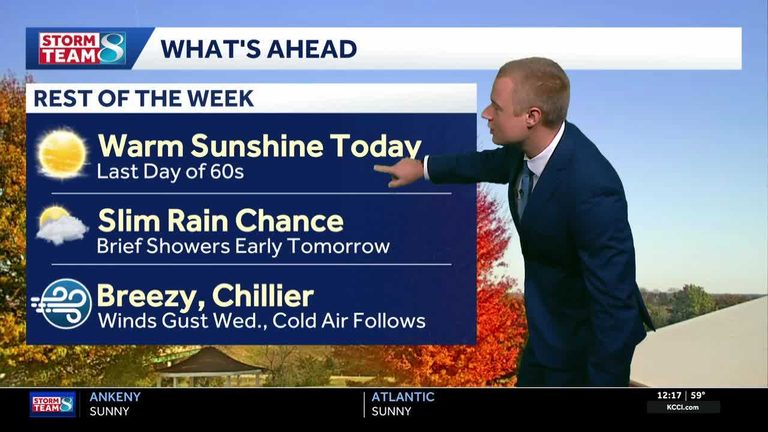
Residents of Iowa can expect another mild day on Tuesday, with plenty of sunshine and temperatures climbing into the low 60s. Light winds will keep the day pleasant, but the forecast shifts dramatically as a shortwave moves across the state later tonight and into Wednesday.
Wednesday brings gusts and a chance of showers
As the shortwave approaches, clouds will begin to build across the region. Winds are set to strengthen, with some locations reporting gusts up to 30 mph. The increased flow may bring a few light showers, especially in the early morning hours. Highs are expected to dip slightly, reaching the upper 50s.
Clipper system ushers in cooler air Thursday‑Sunday
Late Wednesday night, a fast‑moving clipper system will slide through Iowa, pulling a strong north‑northwest flow behind it. This will draw in much drier, cooler air from the north. Thursday morning lows could fall into the mid‑30s, while afternoon highs will linger in the mid‑40s.
Canadian high pressure will settle over the state on Thursday, reinforcing the cold air mass. The result will be a sharp drop in temperatures over the weekend. Friday, Saturday, and Sunday mornings may see lows in the low‑to‑mid‑20s, with daytime highs staying in the mid‑40s throughout the period.
Weekend outlook and early next week
Monday looks quiet and sunny as high pressure remains dominant, allowing temperatures to climb back into the 50s. By Tuesday, a compact low‑pressure area will pass to the north, bringing a southerly flow that should keep temperatures in the low‑to‑mid‑50s through the middle of the week.
Stay informed with local skycams
KCCI offers a network of more than 25 skycams across Iowa, providing real‑time aerial views of conditions. Residents can check the skycam page for up‑to‑date visuals of cloud cover, wind patterns, and any developing precipitation.
Detailed forecast
- Today (Tuesday): Mostly sunny, high near 65°F, light variable winds turning south‑southwest around 5 mph.
- Tonight: Clouds increase late, slight chance of a rain shower early Wednesday, low 45°F, southeast winds 5‑10 mph.
- Wednesday: Chance of an early shower, then clearing skies, breezy north‑northwest winds 15‑20 mph with gusts up to 25 mph, high 57°F.
- Wednesday night: Partly cloudy, low 38°F, north‑northwest winds 10‑15 mph.
- Thursday: Strong north‑northwest flow, possible light rain, low mid‑30s, high mid‑40s.
- Friday‑Sunday: Canadian high pressure brings cold air, morning lows in the 20s, highs staying in the mid‑40s.
- Monday: Quiet, sunny, high 50s.
- Tuesday: Southerly flow returns, high low‑to‑mid‑50s.
Overall, Iowa residents should prepare for a brief period of gusty winds and showers mid‑week, followed by a noticeable cooling trend that will dominate the weekend. Keep an eye on local skycams and KCCI updates for any rapid changes.
Original reporting: KCCI Des Moines — read the source article.