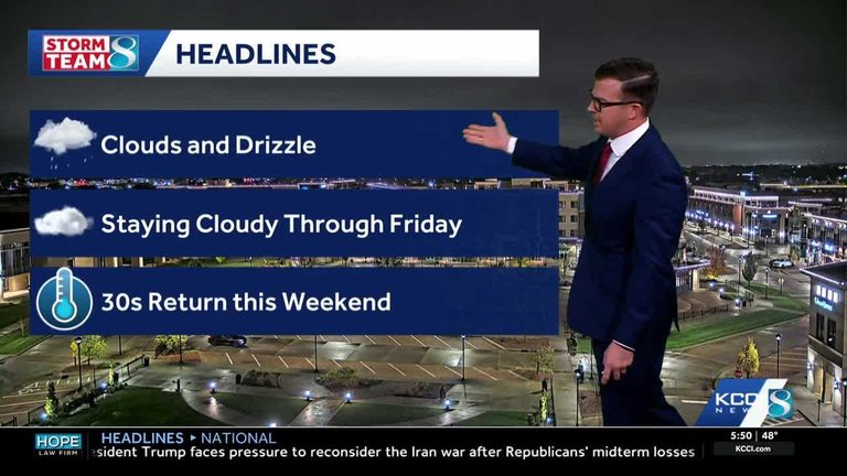
Residents across Iowa should prepare for another cool, cloudy day as patchy drizzle continues into the morning. A steady 10‑15 mph north‑northwest wind is adding a wind‑chill factor, making temperatures feel even colder.
Today’s outlook
High temperatures are expected to reach the low 50s, while gusts may top 25 mph. The drizzle should thin out by mid‑afternoon, but clouds will linger, keeping sunshine limited.
Tonight and Friday
Tonight will be partly cloudy with a low around 39 °F. Light winds will shift to 5‑10 mph. Friday will see decreasing cloud cover through the day, but a lingering cloud deck will keep highs in the mid‑40s. Winds will remain light from the north.
Weekend frost potential
Saturday morning could bring the first frost of the season, especially in areas that clear out early. Eastern Iowa has the highest chance for frost, as lingering clouds may prevent temperatures from dropping into the low 30s. Expected lows are in the mid‑30s, with frost possible where skies clear.
Saturday afternoon should see clearer skies and a modest warm‑up, though highs will stay in the 50s. Sunday will bring more sunshine, with temperatures climbing back into the 60s as the high‑pressure ridge builds.
Looking ahead
Early next week, the trend continues toward drier, sunnier conditions. Highs are projected to return to the 60‑degree range, offering a welcome break from the cooler, damp weather of the past few days.
How to stay informed
For real‑time updates, Iowa residents can check KCCI’s skycam page, which provides live aerial views from more than 25 locations across the state. The skycams are a useful tool for monitoring local conditions, especially for farmers, outdoor enthusiasts, and anyone planning weekend activities.
Overall, while the drizzle and cool temperatures persist through Friday, the weekend promises clearer skies, a chance for a light frost in the morning, and a return to milder weather early next week.
Original reporting: KCCI Des Moines — read the source article.