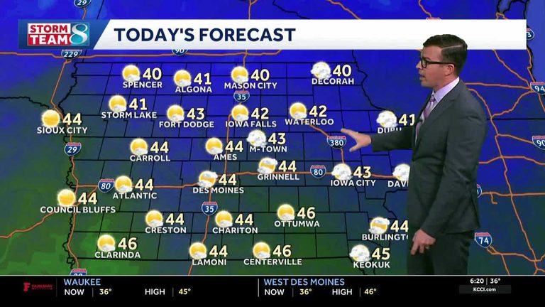
Morning temperatures across Iowa have already slipped into the 30s, feeling more like the 20s thanks to brisk north winds. As arctic air settles over the Midwest, the state is set for a hard freeze this weekend.
Weekend forecast
Saturday will begin with lows in the low to mid‑20s, clear skies and calm winds – perfect conditions for radiational cooling. Wind chills are expected to hover in the 20s and 30s throughout the day. While daytime highs will climb back into the 40s, the coldest air will return early Saturday morning.
A second hard freeze is possible Sunday morning, with temperatures again dipping into the low 20s before the weekend ends. By early next week, highs should rebound into the 50s, offering a brief respite for outdoor chores.
What to expect
Residents should anticipate:
- Morning lows in the low‑20s on Saturday and possibly Sunday.
- Wind chills in the 20s and 30s throughout the weekend.
- Clear skies and calm winds Saturday morning, ideal for efficient radiational cooling.
- Daytime highs returning to the 40s Saturday and Sunday, then climbing into the 50s early next week.
While the forecast calls for dry conditions, the next chance for rain may not arrive until the end of next week.
Stay informed
KCCI’s network of more than 25 skycams across the state provides live aerial views of current conditions. Checking these skycams can help you monitor any sudden changes and plan accordingly.
Current short‑term outlook:
- Today: Mix of sun and clouds, high around 44°F, north winds 10‑15 mph with gusts up to 25 mph.
- Tonight: Partly cloudy, low 28°F, north winds 10‑15 mph.
- Tomorrow: Mostly sunny, high 42°F, north winds 5‑10 mph.
- Tomorrow night: Mostly clear and colder, low 25°F, light and variable winds.
Prepare your home and family for the cold by checking heating systems, protecting outdoor pipes, and dressing warmly when heading outside. With the arctic front moving in, Iowa residents can expect a brisk, frosty weekend ahead.
Original reporting: KCCI Des Moines — read the source article.