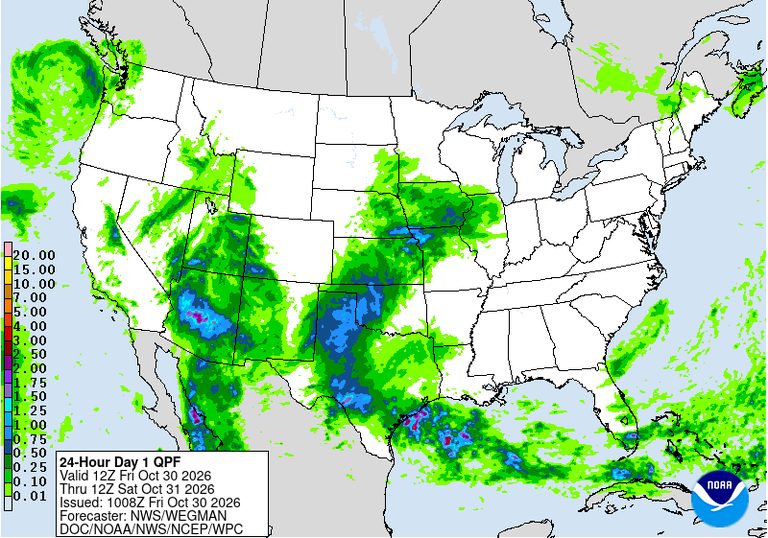
Midland and neighboring Odessa faced flash‑flood warnings early Friday after the National Weather Service (NWS) in Midland/Odessa reported 1 to 1.5 inches of rain already falling, with up to an additional inch possible. The warning, issued at 7:04 a.m. CDT and effective until 10 a.m., covered Ector and Midland counties, including the cities of Midland, Odessa, Greenwood, Goldsmith, West Odessa, Warfield and the Midland International Air and Space Port.
According to Weatherboy.com, the rain was fed by deep moisture tied to former Tropical Storm Vance, which moved inland from the eastern Pacific and retained a high precipitable‑water content of near two inches along the Rio Grande. The NWS noted this was at least the third flash‑flood warning issued that night, following alerts at 3:16 a.m. and 5:27 a.m. for east‑central Ector and northwestern Midland counties.
City officials responded by closing several low‑water crossings as water levels rose, including crossings at Scharbauer and Edwards, Barber, Magnolia, Pine, Benton and the Golf Course, as reported by the Midland Reporter‑Telegram and cited by Weatherboy.com.
The flooding threat extended beyond the twin cities. At 7:02 a.m. CDT, the NWS issued flash‑flood warnings for Dawson and Gaines counties (Lamesa, Seminole, Seagraves) after 1‑2 inches of rain fell. Two minutes earlier, warnings covered Howard, Mitchell and Scurry counties (Big Spring, Snyder, Colorado City) with half an inch to one inch of rain. Central Andrews County received a warning at 5:32 a.m., noting 1‑2 inches already on the ground.
State emergency resources were placed on standby after Governor Greg Abbott directed the Texas Division of Emergency Management to activate response assets. The deployment includes Texas A&M Task Force 1 swift‑water rescue boats, game wardens, rescue helicopters with hoist capability, and Texas Department of Public Safety tactical marine units, according to the governor’s statement referenced by Weatherboy.com.
Forecasters warned that the upper‑level trough driving the moisture would shift eastward by late morning, with most rain expected to exit the area by late afternoon. The NWS forecast discussion indicated that Saturday should be dry, offering “pleasant weather for Halloween” and a break from the current flooding concerns.
Residents are urged to monitor local forecasts, heed guidance from state and local officials, and avoid flooded roadways. The NWS continues to monitor conditions across the Permian Basin, the Big Bend region and parts of southeastern New Mexico through Friday afternoon.
What’s next: The flash‑flood warning remains in effect until 10 a.m. CDT. Additional updates are expected from the NWS as the storm system moves east. Local authorities will reassess road closures and emergency response needs later this morning.
Sources: weatherboy.com