Early this morning the last of the rain moved out of eastern New Mexico, and snow flurries wrapped up around Taos and the Sangre de Cristo Mountains. With precipitation easing, the focus shifts to fog and low clouds that are expected to linger into the early hours.
Fog advisory in effect
A Dense Fog Advisory is currently in place for areas around Moriarty and down toward Ruidoso until 7 a.m. Travelers should expect slower traffic and reduced visibility. Outside the advisory zone, additional pockets of low clouds and fog may develop later this morning.
Today’s weather outlook
The afternoon looks sunny for most of the state, though high temperatures will remain modest, staying in the 40s and 50s across northern New Mexico. Thursday morning may bring a few more foggy spots, but overall it should be a quiet, sunny day with afternoon highs climbing back into the 60s.
Upcoming storm system
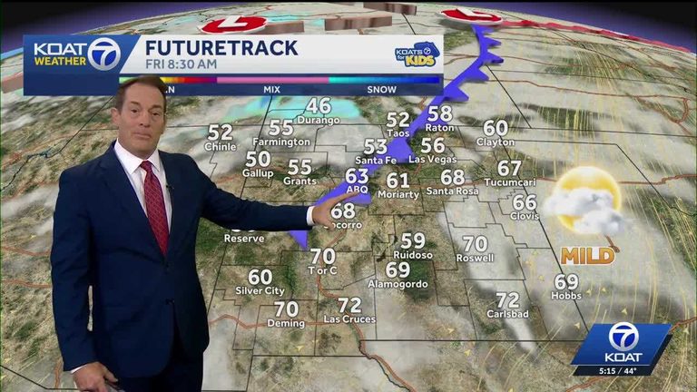
The next Pacific storm is set to arrive on Friday, bringing rain and mountain snow to northwest New Mexico and the Four Corners region. The rest of the state can expect milder temperatures with breezy to windy conditions.
Weekend forecast
Saturday could see a mix of rain, wintry mix, and snow showers across northern and central New Mexico, accompanied by cooler temperatures. Sunday offers a brief break, though Albuquerque may dip below freezing for the first time this season on Sunday morning before enjoying a sunny, cool afternoon.
Looking ahead
Monday may bring another round of rain and snow, though the timing and intensity remain uncertain. Current model trends suggest the system could affect the area later Monday into Tuesday morning.
Original reporting: KOAT Albuquerque — read the source article.