Are you expecting a flat canal-side stroll with a few ducks and maybe a distant mountain view? That’s the reasonable assumption when someone mentions hiking near Lake Lowell. It’s what most people picture — and it’s not entirely wrong. But the Ridgeline Trail on the south side of the reservoir gives you something the flat shoreline access points don’t: elevation, exposure, and a view that stops you mid-step.
The trailhead sits off Lake Shore Drive on the reservoir’s south end, past the quieter residential stretch where the road narrows and the houses thin out. There’s a small pull-off area — nothing formal, no kiosk, no fee station. You park, you walk. That low-key entry is part of why locals treat this like their own discovery, even though it’s federal land open to anyone.
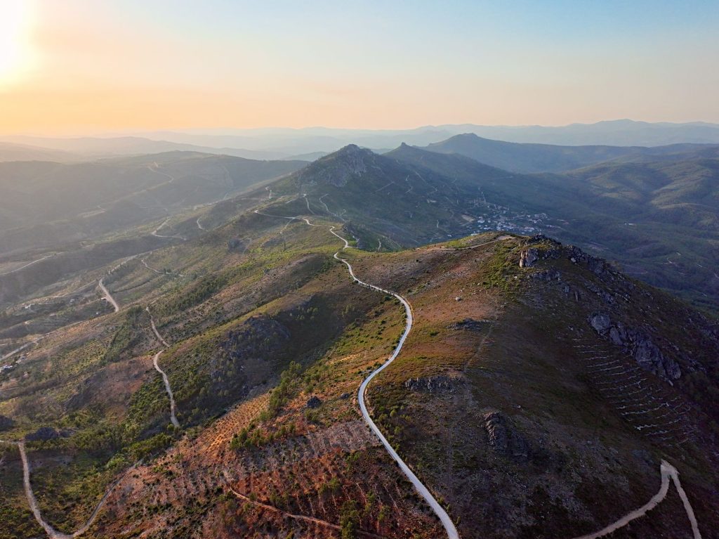
The trail climbs a basalt ridgeline above the water, and once you’re up there — maybe fifteen minutes into a moderate push — the whole of Lake Lowell opens below you. On a clear morning in October or March, the Owyhee Mountains stack up to the southwest in that particular pale blue way they get before noon, and the reservoir reflects enough sky to make the whole scene feel twice as large. You’ll see waterfowl working the water from a height that binoculars actually improve rather than replace.
The terrain is high desert scrub: sage, rabbitbrush, basalt outcroppings, the occasional kestrel threading between. It’s not a lush trail. If you’re expecting shade or riparian softness, you won’t find it. What you get instead is openness — big sky in every direction, wind that moves through without obstruction, and a sense that Nampa is nearby but not particularly relevant to what you’re doing right now.
Distance varies depending on how far along the ridge you push, but a reasonable out-and-back runs three to four miles and takes most people ninety minutes to two hours. The footing is rocky in spots, so wear actual hiking shoes rather than runners. No mountain biking here — this is foot traffic only, and the wildlife refuge rules hold: no dogs off-leash, stay on designated trails during nesting season (roughly March through mid-July), and check current refuge access on the USFWS website before you go, since sections occasionally close for wildlife management.
The best times are early fall and late winter, when the light is low and angled and the heat isn’t a factor. Summer mornings work if you’re out by eight — by ten it’s cooking. Bring water regardless of season; there’s nothing to refill from out there.
Cost is what federal wildlife refuges typically charge: nothing. The trailhead has no facilities, so plan accordingly. Cell service is inconsistent along the ridge, which is either a problem or a feature depending on what you’re looking for on a Sunday.
People drive past this area constantly on their way to the main Lake Lowell recreation areas without registering that the ridgeline above them is walkable. That’s their loss. If you want to see a surprising amount of the Treasure Valley from a basalt spine above a desert reservoir on a clear Idaho morning, this is the specific place to do it.