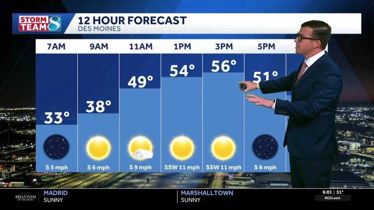
Residents across Iowa can look forward to a milder week after a chilly start to the morning. A strong high‑pressure system will dominate the first half of the week, keeping skies clear and winds from the south and southwest steady.
Day‑by‑day outlook
Today: Sunny skies with a high near 56°F. South winds will be 10‑15 mph, providing a gentle lift in temperature.
Tonight: Clear conditions will persist, with lows dropping to the mid‑30s. Winds remain light from the south.
Tuesday: Breezy conditions return as south‑southwest winds increase to 15‑20 mph. Temperatures will climb into the upper 50s, continuing the warming trend.
Wednesday: Expect the warmest day of the week, with highs reaching the low 60s. The sky will stay mostly sunny, and winds will stay moderate.
Thursday: South and southwest breezes keep temperatures in the low 60s. The sky remains mostly clear, but the moisture surge from the Gulf begins to edge into the forecast.
Friday into Saturday: Scattered showers become likely as a weak cold front pushes through the state. Wind gusts may approach 30 mph, bringing brief bursts of rain and a cooler feel.
Sunday and beyond: The rain will taper off, allowing the atmosphere to dry out. Temperatures will dip back toward the 50s as the week ends, setting the stage for a cooler start to next week.
How to stay informed
For real‑time updates, Iowa residents can monitor KCCI’s skycam network, which offers live aerial views from more than 25 locations across the state. The skycams provide a clear picture of changing conditions, especially useful when breezy winds and scattered showers are in the forecast.
Whether you’re planning outdoor activities, commuting, or simply checking the evening sky, keeping an eye on the latest radar and alerts will help you stay prepared for the shifting weather patterns.
Original reporting: KCCI Des Moines — read the source article.