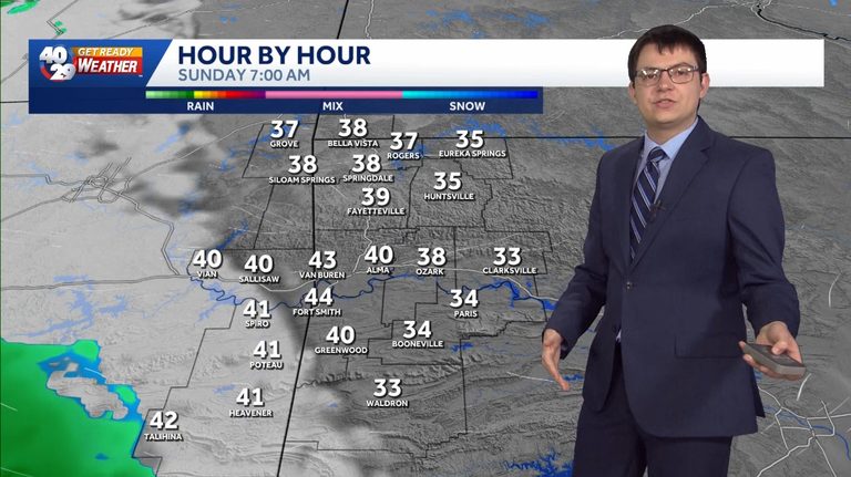
Fayetteville, Ark. – The 40/29 Get Ready Weather Team is forecasting a cool, overcast Sunday across Northwest Arkansas and the River Valley. Morning lows will be milder than the recent early‑morning chills, giving families a comfortable start to the day.
Sunday’s Weather Details
Temperatures are expected to hover in the mid‑40s to low‑50s Fahrenheit, with cloud cover dominating the sky from sunrise through the afternoon. While the air will feel cooler than the past few mornings, it will not reach the bitter lows seen earlier this week.
Light rain showers could develop later in the day, especially over the River Valley corridor. These showers are projected to be brief and scattered, posing little risk of severe weather but enough to bring a dampening effect to outdoor plans.
Monday Outlook
Looking ahead to Monday, the forecast shifts to sunnier skies and a modest temperature rise. Highs are anticipated to climb into the upper 50s, offering a pleasant warmup after Sunday’s cooler conditions.
Residents who enjoy outdoor activities should consider scheduling any weekend outings for the morning hours on Sunday or waiting until Monday when the sun returns and the chance of rain diminishes.
Stay Informed
The 40/29 News team encourages viewers to keep an eye on the interactive radar and live skycams available on the station’s website for real‑time updates. The free 40/29 News app also provides personalized alerts to help families stay safe during any sudden weather changes.
Chief Meteorologist Darby Bybee, along with meteorologists Laura Huckabee, Drake Foley, and Cole Makos, will continue to monitor conditions and provide updates throughout the weekend. For the most current information, tune in to the 40/29 Weathercast or visit the station’s online portal.
Original reporting: 40/29 / KHBS (NW Arkansas) — read the source article.