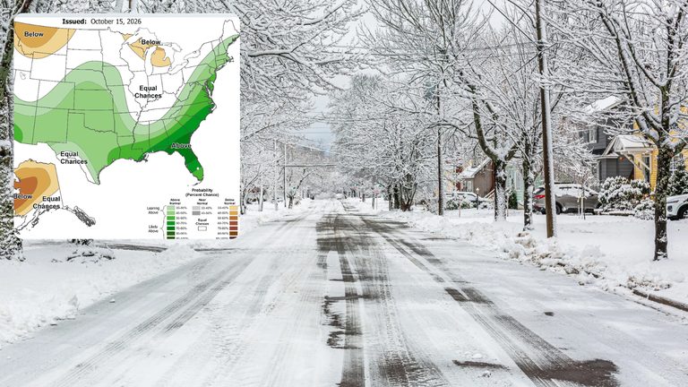
As holiday lights go up and temperatures dip, Cincinnati residents are wondering how much snow to expect this winter. The National Weather Service and local forecasters point to a strong “super” El Niño pattern as the dominant influence on the season’s weather.
What a super El Niño means for the Ohio Valley
El Niño events typically bring warmer‑than‑normal conditions to the northern United States and wetter‑than‑normal conditions to the south. In the Ohio Valley, the usual pattern is milder temperatures and less snowfall than average. A “normal” winter in Cincinnati averages about 20.5 inches of snow.
Historical super El Niño winters in Cincinnati
Looking back at the three most recent super El Niño winters—1982‑1983, 1997‑1998, and 2015‑2016—provides a mixed picture. Data from Cincinnati/Northern Kentucky International Airport (CVG) and the National Weather Service office in Wilmington, Illinois (ILN) show that snowfall totals can vary widely.
- 1982‑1983: Both CVG and ILN recorded a modest 6.6 inches of snow, well below the normal average.
- 2015‑2016: Snowfall was close to normal, with CVG reporting 19.2 inches and ILN 18.5 inches.
- 1997‑1998: CVG saw a heavy 31.4 inches, while ILN recorded 19.4 inches, driven by a record‑setting snowstorm in early February.
The 1997‑1998 season featured a remarkable East Coast storm from February 4‑6, 1998, that dumped 18.5 inches of snow in Cincinnati—11.8 inches fell on February 4 alone, the city’s largest one‑day snowfall on record. Snow totals across southern Ohio that storm ranged from 8 to 24 inches.
What to expect this winter
Given the current super El Niño, forecasters anticipate a generally warmer and drier winter for Cincinnati. However, the historical record reminds us that variability is possible. In two of the three past super El Niño winters, the first measurable snowfall (0.1 inch or more) did not occur until the second week of January, suggesting a slower start to the season.
Residents should still be prepared for occasional heavy snow events, especially if a strong storm tracks westward from the East Coast. While the overall trend points toward fewer snow days, the occasional “snowball fight”—where a significant storm delivers a sudden burst of snow—remains a realistic scenario.
Practical tips for families
Families planning holiday travel or outdoor activities should monitor local forecasts, especially in late December and January, when the first measurable snow may arrive. Keeping an eye on updates from the National Weather Service and local stations will help ensure safe travel and timely preparation for any unexpected snowfall.
Overall, this winter’s super El Niño offers the promise of milder weather and reduced snow removal burdens for Cincinnati, while still leaving room for occasional winter surprises.
Original reporting: WLWT Cincinnati — read the source article.