Madison and the broader southern Wisconsin region will see dry conditions today after several days of clouds and rain. Sun will mix with clouds this afternoon, pushing highs into the mid‑ to upper 40s. A north wind will make it feel cooler, especially in open areas.
Weekend Forecast
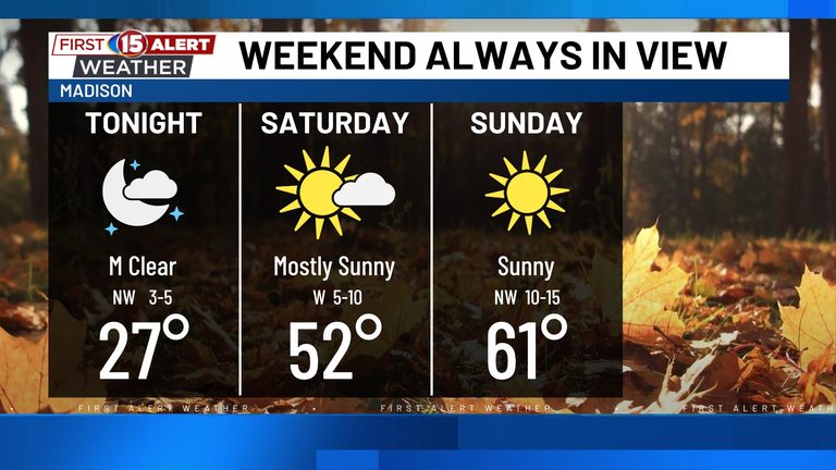
Cloud cover will vary across the region. Madison and communities farther west will enjoy the most sunshine, while clouds may linger farther east, though no additional rain is expected. Skies will clear gradually Friday evening, winds will ease, and temperatures will fall quickly overnight.
By Saturday morning, much of southern Wisconsin will sit in the mid‑ to upper 20s, marking one of the coldest nights so far this fall. Saturday afternoon will become more comfortable as sunshine mixes with clouds, winds lighten, and highs climb to around 50 degrees.
Badger fans heading to the UW football game should expect dry weather with temperatures ranging from the upper 40s to about 50 degrees. A jacket is advised as temperatures will dip later in the afternoon.
Sunday Through Mid‑Week
Sunday will remain dry with highs reaching the mid‑50s. Winds will pick up slightly as milder air returns to southern Wisconsin.
The warm‑up continues on Monday as southwest winds push highs into the lower 60s—much warmer than Saturday morning’s 20s and above normal for November.
A cold front moves through Monday night, bringing limited moisture and little, if any, rain. Highs on Tuesday and Wednesday will settle in the mid‑ to upper 50s, slightly warmer than average.
Another weak system could approach around mid‑week, but rain chances stay low. The dry stretch is expected to continue through at least Wednesday.
Overall Outlook
November began damp, but this weekend offers a break from the rain. Saturday starts chilly, then turns dry, and milder temperatures return early next week.
Original reporting: NBC15 WMTV (Gray) – local — read the source article.