Jackson, WY – Residents can expect a wet weekend as subtropical moisture moves back into the Tetons. Light rain showers are forecast for Friday and Saturday, with a broader, heavier rain event arriving on Sunday.
Snow levels stay high
For most of the weekend, snow levels will remain near or above 9,000 feet, keeping the town of Jackson free of measurable snowfall. A cold front later Sunday or Sunday night should push snow levels down to the 7,000‑8,000‑foot range by Monday morning, low enough for snow to accumulate on Teton Pass and potentially affect early‑week travel.
Recent weather recap
The Tetons have seen two distinct systems this week. The first, from October 22‑23, dropped snow levels from around 10,000 feet to 8,000 feet on Friday night, delivering 4‑7 inches of snow above 9,000 feet and 1‑2 inches down to 8,000 feet on the east side. Most of that snow melted below 9,500 feet over the weekend. Rainfall in the valleys ranged from 0.4 to 0.8 inches, with Jackson recording 0.72 inches.
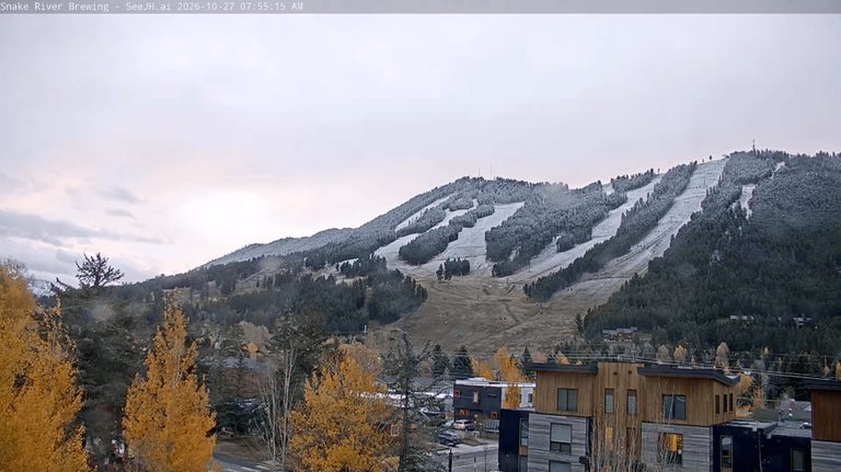
A second, colder system on Monday night pushed snow levels to about 6,700 feet, allowing a light dusting on the mid‑upper slopes of Snow King and creating the first winter‑travel impacts of the season on Teton Pass. Snow totals of 1‑3 inches caused slick roads, a brief closure, and several accidents.
A weaker disturbance on Tuesday‑Tuesday night produced light snow and graupel showers with minimal accumulation. Jackson saw a few flakes of snow and graupel, but none were measurable.
October precipitation outlook
Jackson has already received an impressive 2.84 inches of rain this October, well above the average 1.75 inches. Light rain showers are expected at the end of the month, likely bringing the total just shy of three inches.
Temperature trends
Mid‑week temperatures have been seasonally cool, with highs only reaching the upper 40s on Wednesday. Thursday should warm into the 50s, and the weekend will see a gradual rise in cloud cover as moisture builds.
Looking ahead
Saturday’s showers should remain light, keeping Halloween weekend relatively dry. Sunday’s stronger surge of moisture could bring heavier rain across the area, but the bulk of the precipitation will stay above the town’s elevation.
After the cold front moves through, snow levels are projected to dip to 7,000‑8,000 feet by Monday morning, making snow on Teton Pass a real possibility. While it is unlikely that snow will reach the lower valley floor around Jackson, the forecast remains uncertain and could change.
Beyond the weekend, a ridge of high pressure is expected to dominate the Interior West starting Tuesday, bringing a milder, drier pattern through the first week of November. Precipitation chances should diminish, though a stray system could still sneak in later in the month.
— Alan Smith, Meteorologist
Original reporting: Buckrail (Jackson WY) — read the source article.