Snow‑capped peaks of the Sangre de Cristo Mountains north of Taos were blanketed on Oct. 26, while days of rain and snow left the Taos Ski Valley with about four inches of new snow over the past week, according to skitaos.com.
River levels surge amid storm system
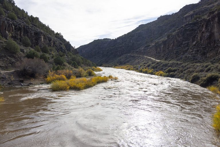
By Tuesday, Oct. 27, the Rio Grande was flowing two feet higher than its typical level for this time of year. The rise reflects the cumulative effect of several days of heavy rain that saturated the ground and boosted river flow.
Provisional data from the U.S. Geological Survey gauge at the Pilar Bridge recorded a flow of 2,470 cubic feet per second on Monday, Oct. 26 – a stark contrast to the modest peaks of 700 cfs seen only once in the past year.
Potential benefits for agriculture and recreation
Experts say the added moisture could be a boon for the Taos Valley’s agricultural season, which suffered last winter from a thin snowpack and limited irrigation water. Snowmelt in the spring traditionally replenishes streams that support both farms and the region’s white‑water rafting industry, which has struggled without reliable water flow.
“If the El Niño pattern holds, we can expect continued precipitation through January, which should help restore the water balance for both crops and recreation,” said a spokesperson from the ENSO Center.
Weather outlook
National Weather Service forecasts for the coming week call for temperatures that are average for this time of year across most of New Mexico, with slightly above‑average warmth in the eastern part of the state. The agency also warned that additional storm activity is expected to move into north‑central New Mexico beginning Friday, Oct. 30, and continue through the weekend.
Related impacts
While the Upper Rio Grande Valley avoided the severe flooding seen elsewhere in the state, the San Juan River in northwest New Mexico reached historic levels, causing widespread damage in communities such as Bloomington. The Animas River also recorded record flows.
Governor Michelle Lujan Grisham’s office announced a request for additional federal assistance to aid recovery efforts in Santa Fe County after a rare tornado touched down in a Santa Fe neighborhood, damaging at least ten homes.
Hydrologist’s perspective
Andrew Mangham, senior service hydrologist with the National Weather Service in Albuquerque, highlighted the Rio Puerco as the “big show right now,” noting its gauge reading of 20.62 feet – a level not seen since the mid‑1940s. He cautioned that while the river is currently at minor flood stage, it could approach moderate flood levels if the trend continues.
Overall, the recent precipitation surge offers a hopeful sign that the region’s water resources may recover before the end of the year, supporting both the local economy and the families who depend on reliable irrigation and outdoor recreation.
Original reporting: Taos News — read the source article.