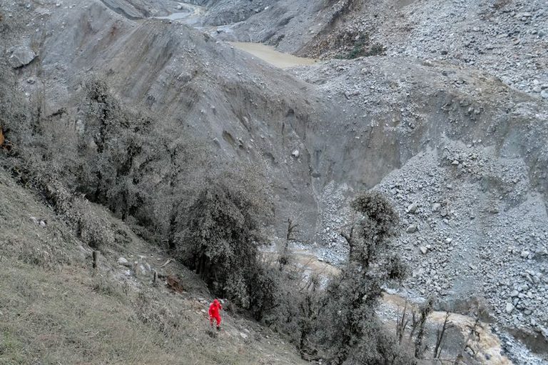
BEIJING — The danger of a sudden lake burst in the disaster zone along the China‑Nepal border has lessened, Chinese authorities said Saturday after satellite data showed the water body shrinking.
Lake size drops, flood threat eases
Images taken from Thursday to early Saturday morning indicate the lake, created by a massive glacier collapse, has lost roughly 21,000 square meters of surface area. The Water Resources Ministry reported the lake now covers about 99,000 square meters – roughly the size of 14 football fields – down from 120,000 square meters two days earlier.
Rescue efforts continue amid challenging conditions
State‑owned engineering and rescue firm China Anneng has been monitoring the lake since the collapse. A 15‑member team deployed drones, portable satellite stations and mobile cameras to track water levels. An overflow on Friday briefly halted rescue work, but officials later deemed the risk manageable.
More than 50 rescue workers combed the rubble of the Gyirong border crossing complex, where a powerful torrent of rock, ice, mud and debris swept away the port complex on Wednesday, killing hundreds and leaving thousands missing. The area remains difficult to access as roads and communications are cut off.
Additional water body poses future risk
Authorities also identified a larger body of water at the base of the collapsed glacier, estimating its surface area at over 120,000 square meters, though its depth remains unknown. Flood risks will persist until both lakes fully drain, according to a Nepal Disaster Management Authority official.
China’s death toll from the disaster rose to seven, with 554 people still missing. Nearly 500 villagers and construction workers, along with all 555 tourists in the area, have been evacuated.
Rescue teams, aided by a search‑and‑rescue dog, continue to search for survivors amid bleak, rainy weather, calling out to any signs of life in the devastated valley.
Original reporting: Appleton, WI News Feed (HLL/CB) — read the source article.