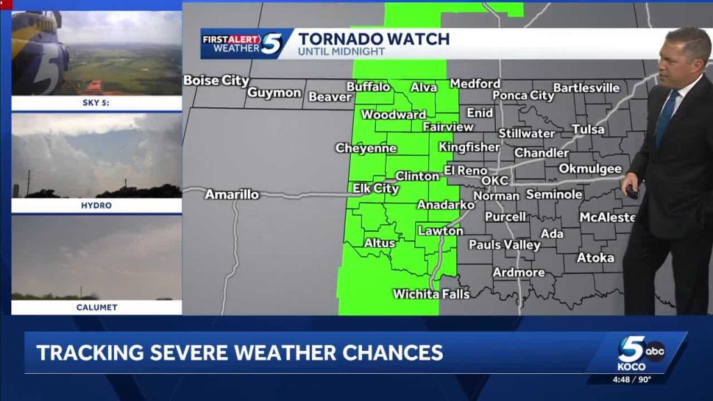
Oklahoma faces another round of volatile weather as two separate storm waves sweep through the state on Monday into early Tuesday, raising the risk of severe thunderstorms, damaging winds, large hail, and possible tornadoes across much of the region. Local emergency managers and forecast offices are warning residents from northwest Oklahoma down through the central and southern counties to monitor conditions closely and be ready to act if warnings are issued.
The first line of storms will move in during the afternoon and evening hours on Monday, packing an immediate threat of damaging gusts and hail as it crosses the plains. Expect loud thunder, frequent lightning, and sudden downpours that can drop visibility in a matter of minutes. These cells are capable of producing embedded tornadoes, especially where wind shear and low-level moisture are strongest.
A second surge of energy is forecast to arrive late Monday night into the early Tuesday hours, bringing renewed risk to areas that thought the danger had passed. Nighttime tornadoes are particularly dangerous because people are often asleep and less able to respond quickly to warnings. That means having multiple ways to receive alerts and readying safe shelter becomes even more important as evening approaches.
Beyond tornadoes, straight-line winds could reach damaging strength and create widespread tree and power-line damage, leading to outages that may last hours or longer in rural pockets. Large hail will be a concern for vehicles, roofs, and crops, and sudden heavy rain can quickly produce localized flash flooding, especially over urban areas and poor-drainage roadways. Drivers should avoid attempting to cross flooded roads; a small amount of moving water can wash a car off the roadway.
Communities across the state should treat the forecast with urgency and not assume the threat will miss them. Schools, businesses, and families should review their severe-weather plans and make sure everyone knows where to go for protection. Mobile home residents and those in flimsy structures should plan to move to sturdier shelter if a tornado warning is issued.
Simple preparedness actions can make a big difference during fast-moving severe weather. Keep a battery-powered radio or charged phone with alert capabilities nearby, gather essential items like medications and important documents into a grab-and-go bag, and identify a small interior room or basement where you can shelter without windows. If you have a NOAA Weather Radio, program it for local emergency alerts to cut through noise and provide timely warnings.
Local officials urge people to act immediately if a warning is issued for their area and not to wait for confirmation from neighbors or social media. When a tornado warning sounds or flashes, cover your head and neck, get low, and use sturdy furniture or mattresses to shield against flying debris. If you are driving and a tornado is imminent, seek shelter in a nearby sturdy building; if that is not possible, lie flat in a low spot away from vehicles and cover your head.
Power companies and emergency services are positioning crews and resources to respond quickly to outages and storm damage after the storms pass. Residents should avoid downed power lines and report outages and hazards through official channels. Community emergency shelters may open if sustained damage occurs, and local media will provide updates on road closures and recovery efforts.
Forecasters emphasize that conditions can change quickly, so keeping an eye on updated watches and warnings from the National Weather Service is key. Pay attention to short-term weather updates and be ready to move to safety at a moment’s notice, especially during the late-night period when the second wave is expected. Preparedness now reduces panic later and can help protect lives and property when storms move through.


