Kentucky is experiencing a beautiful morning with plenty of sunshine, thanks to high pressure controlling the weather. This will lead to a pleasant summer day across much of the region.
Temperature and Humidity
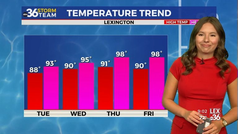
Temperatures will warm into the upper 80s, with some areas possibly reaching 90 degrees. Humidity will be noticeable, but heat index values should stay close to the actual air temperature, making it feel more comfortable than later in the week.
Most areas will remain dry, but isolated showers or thunderstorms may develop in southern Kentucky, especially near the Tennessee border, and eastern Kentucky during the late afternoon or early evening. Any storms that form will be slow-moving and short-lived.
Weekend Outlook
As the week progresses, summer heat will become more noticeable, with afternoon highs climbing into the lower 90s and dew points rising into the 70s. This will push heat index values into the 100 to 103 degree range across much of the area.
Rain chances will also increase, with Thursday bringing the chance for isolated afternoon thunderstorms and Friday offering the highest chance for more widespread showers and thunderstorms. The weekend will see daily chances for afternoon and evening showers and thunderstorms, with temperatures remaining warm.
Original reporting: WTVQ (Lexington) — read the source article.