North Texas is bracing for intense summer heat and Saharan dust ahead of the Fourth of July. While heat alerts grip more than 20 states, North Texas will experience its own distinct brand of summer swelter this week.
Monday Forecast
Temperatures are running a couple of degrees above average, climbing rapidly through the 90s after an uncomfortably warm morning start. Western communities are seeing higher thermometer readings due to drier air heating more efficiently than moisture-rich air.
Trips to the triple digits are anticipated by late afternoon for areas like Breckenridge and Graham, while the Dallas-Fort Worth Metroplex is expected to top out between 98 and 99 degrees. Southern and eastern edges of the region will remain five to seven degrees cooler on the thermometer.
Tuesday Forecast
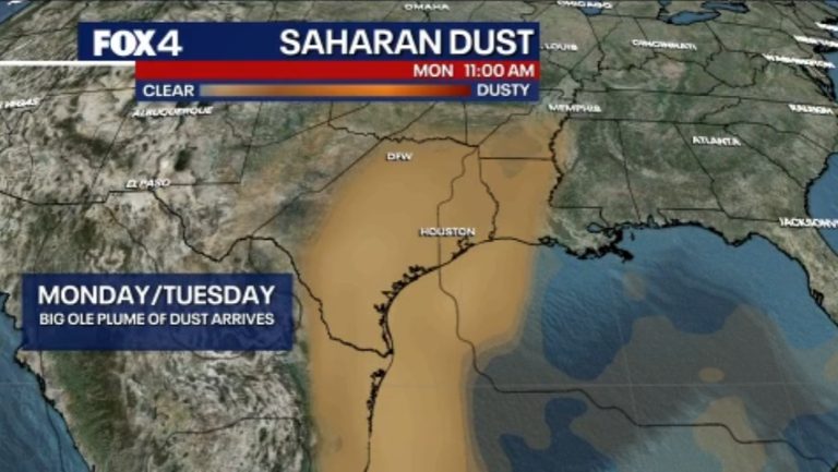
The persistent heat pattern carries directly into Tuesday with little change. Highs across the region will comfortably settle back into the upper 90s, mimicking today’s temperatures. Southerly winds will keep the air moving, and the Saharan haze is expected to linger across regional skies.
A slight reprieve from the wind arrives Wednesday as regional air currents calm, causing a minor dip in the overall temperature trend. The break is short-lived, however, as temperatures climb back toward the upper 90s by the end of the workweek, stopping just shy of the triple-digit mark.
Heading into the holiday weekend, North Texas will maintain its classic summer rhythm. The active weather pattern dictating the first half of the week is expected to level out, keeping the area warm and dry. Independence Day celebrations are currently forecast to feature slightly lower wind speeds compared to the start of the week, clear to partly cloudy skies, and daytime highs holding steady in the upper 90s—providing a reliably hot, dry backdrop for area fireworks and outdoor events.
Original reporting: Dallas – Ft. Worth Feed (HLL/CB) — read the source article.


