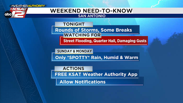
San Antonio residents are advised to stay alert as the city experienced significant rainfall earlier today, with some areas receiving between one to three inches. The National Weather Service has issued a Flood Watch for the region, effective through Monday, due to the potential for street flooding and strong storms.
Saturday’s initial storm system moved out in the early afternoon, but forecasters warn that additional storms could develop later this evening. These storms may bring quarter-sized hail and damaging wind gusts, with heavy downpours being the primary concern. Residents are encouraged to keep informed through local weather updates and to have the KSAT Weather Authority app handy for real-time information.
Memorial Day Weekend Outlook
For those planning outdoor activities this Memorial Day weekend, weather conditions are expected to be calmer on Sunday and Monday. While isolated showers may occur, they will likely be driven by afternoon heating. The chance of rain on Sunday is around 30%, with even lower odds anticipated for Memorial Day.
Looking Ahead to Next Week
After a brief respite from widespread rain on Sunday and Monday, another low-pressure system is expected to move across South Central Texas. This system will increase the likelihood of storms from Tuesday afternoon through Wednesday morning. Following this, a drier and warmer weather pattern is predicted to settle in by the end of the week.
Original reporting: San Antonio, TX News (HLL/CB) — read the source article.


