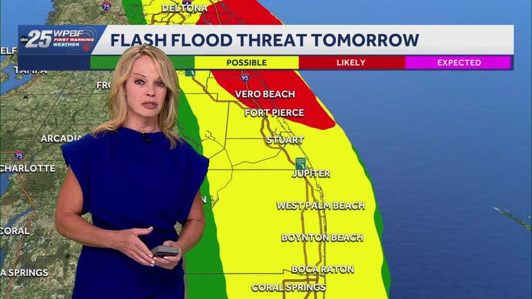
Residents of South Florida should prepare for a heightened flood risk beginning this evening. The National Weather Service has placed a Flood Watch in effect at 5 p.m. today, extending through Thursday at 7 p.m. The advisory follows a disturbance moving in from the Gulf of Mexico that is expected to dump significant rain on areas still recovering from earlier flooding this month.
What the forecast means
Forecasters anticipate steady to heavy rain showers throughout the watch period, with the greatest amounts expected overnight and into Thursday morning. Ground conditions are already saturated, so even moderate rainfall could cause street flooding, especially in low‑lying neighborhoods and near waterways.
In addition to the rain, a High Surf Advisory is also active. Coastal communities should expect larger than normal waves and stronger rip currents, prompting swimmers and boaters to exercise caution. Winds are projected to gust between 25 and 35 mph today, adding to the potential for downed branches and minor power disruptions.
Safety tips for families
Parents and caregivers are urged to review emergency plans with their children. Keep flashlights, batteries, bottled water, and non‑perishable food supplies on hand. If you live in a flood‑prone area, consider moving valuables and important documents to higher ground.
Drivers should avoid low‑lying roads that are prone to flash flooding. If water begins to rise around your vehicle, abandon it and move to higher ground—do not attempt to drive through standing water.
Local response
County emergency management offices are monitoring the situation closely and stand ready to deploy sandbags, rescue crews, and temporary shelters if needed. Residents can stay updated through local news outlets, official social‑media channels, and the National Weather Service’s website.
While the forecast calls for challenging conditions, the watch also provides an opportunity for communities to act proactively. By heeding the warnings and preparing ahead of time, families can protect lives and property while the storm passes.
Looking ahead
Temperatures are expected to remain in the 80‑degree range today, offering a brief respite from the cooler mornings that have characterized recent weather patterns. However, the focus remains on the rain and its potential to exacerbate existing flood concerns.
Stay tuned for any updates to the Flood Watch or High Surf Advisory, and follow local authorities’ guidance to stay safe throughout the next few days.
Original reporting: WPBF (Treasure Coast / Hearst) — read the source article.