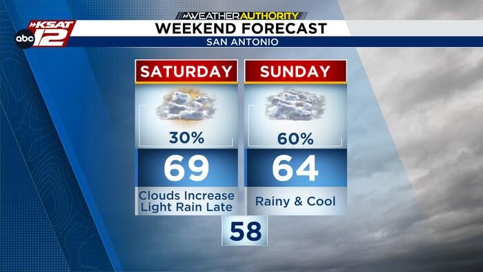
South‑Central Texas residents should plan for a shift in the weather this weekend. Saturday is shaping up to be largely dry, with mostly clear skies and temperatures climbing into the upper 60s. A few isolated showers may pop up later in the day, but outdoor plans are still viable.
Sunday brings rain and cooler highs
Sunday’s forecast is markedly different. Expect a cool and wet day across the region, with scattered showers and periods of rain throughout the day. High temperatures will dip into the low 60s around San Antonio and fall into the 50s in the Hill Country. While widespread flooding is not anticipated, some locations could receive up to an inch of rain, and stronger storms are possible, especially toward the Coastal Plains.
Those heading out on Sunday should be prepared for variable conditions. It will be warmer farther south, near Del Rio, so consider indoor alternatives for any planned activities. An indoor backup plan will help avoid disruptions from sudden downpours.
Looking ahead: a chilly start to the week
Cooler, drier air will move in Sunday night, setting the stage for a chilly start to the workweek. Monday and Tuesday are expected to see highs near 60°F, followed by dry weather through Wednesday. By the end of the week, humidity and rain chances will return, bringing another round of precipitation.
Residents can stay updated on the evolving forecast through local weather outlets and the National Weather Service. Planning ahead for the cooler, wetter conditions will help keep families and communities safe and comfortable.
Original reporting: San Antonio, TX News (HLL/CB) — read the source article.