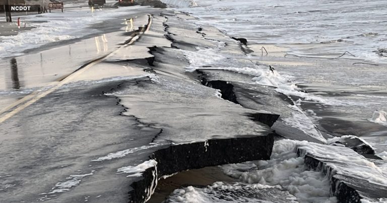
The North Carolina Department of Transportation (NCDOT) has filed a proposal to relocate roughly 3,000 feet of the heavily damaged N.C. 12 corridor on Hatteras Island. The new alignment would sit about 180 feet west of the current roadway near the Pea Island National Wildlife Refuge Visitor Center, creating a short‑term solution while longer‑term options are debated.
Why the move matters for island residents
For the past two weeks, traffic on N.C. 12 has been limited to a single‑lane paved detour, with two traffic lights controlling northbound and southbound flow. While the detour keeps the island’s “lifeline” open, drivers often wait several minutes, and local businesses have suffered a loss of roughly a month’s revenue.
“It’s almost a month of business that we lost for me,” said Wendell Blancaflor, operator of the Hoy! Lechon food truck in Rodanthe. Blancaflor, a longtime resident of Kill Devil Hills, added that the road’s instability has directly threatened the viability of his seasonal operation.
Bo Melton, owner of the Heart of Rodenthe restaurant, echoed the sentiment: “I had a pretty good first year going, and then October came and it just completely shut down.” Both owners stress that any improvement to the roadway is critical for the island’s economy and for families who rely on tourism.
Details of the proposed relocation
The NCDOT plan calls for a new 30‑foot‑wide, two‑lane paved road built adjacent to the existing Cape Hatteras Electric Cooperative power line. The proposal includes a 100‑foot highway easement (50 feet on each side of the new centerline) and the abandonment of the current easement after the old road is removed.
Additional components of the project are:
- Relocation of a single power pole (Pole 75) about 15 feet west within the existing utility easement.
- Filling of approximately 1,714 square feet of jurisdictional wetlands and 2,317 square feet of open water at the turtle pond behind the restrooms.
- Construction of a new dune roughly 15 feet high and 45 feet wide, planted with sea oats or American beach grass.
- Demolition and reconstruction or relocation of the Pea Island Visitor Center, its parking area, and the North Pond restrooms and wastewater system.
- Removal of the existing roadway and sandbag structures once traffic is shifted to the new alignment.
Community response and next steps
Local stakeholders have welcomed the proposal as a “good start,” but they stress that a permanent solution—such as elevated roadways or additional bridges—remains essential. “In my opinion, road elevation will be the key,” Blancaflor said, noting the success of the nearby Richard Etheridge Bridge in stabilizing the inlet and encouraging dune growth.
The public comment period is open until November 24, giving residents, business owners, and conservation groups a chance to weigh in. The U.S. Fish and Wildlife Service and the National Park Service will review the environmental aspects of the plan before any final decision is made.
Why this matters for Hatteras Island families
Reliable transportation is a cornerstone of family life on Hatteras Island. When N.C. 12 closes, not only are tourists delayed, but essential services—schools, medical facilities, and supply deliveries—are disrupted. By relocating the road and eventually pursuing elevated options, the community can safeguard both its economy and the safety of its families.
For those who wish to submit comments, the full list of proposals and instructions are available on the NCDOT website. Continued engagement from island residents will help ensure that the final design reflects both practical needs and the preservation of the island’s natural beauty.
Original reporting: WTKR News 3 (Scripps) – local — read the source article.