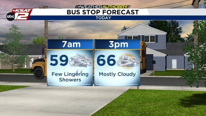
Residents of central Texas can look forward to a short break in the rain later today. Morning showers will linger into the early afternoon, but conditions are expected to clear as the day progresses, allowing for a more pleasant evening.
Today’s Outlook
Morning skies will be mostly cloudy with isolated showers possible as a low‑pressure system finally exits eastward. Temperatures will hover in the 60s, with a high near 67°F. Expect spotty rain through midday, then a gradual decrease in precipitation this afternoon, giving way to drier air.
Wednesday – Sunshine Returns
Cloud cover will dominate the first half of Wednesday, but the sun is set to break through later in the day. As sunshine returns, temperatures are projected to climb into the 70s. The evening will remain mostly clear, offering a welcome respite after several days of steady rain.
Thursday and Friday – Low Humidity, Sunny Skies
Both Thursday and Friday are shaping up to be dry and sunny, with low humidity levels that should make outdoor activities more comfortable. High temperatures will stay in the low 70s, and the sky will stay mostly clear throughout the day.
Weekend Outlook – New Storm System
A new storm system is expected to move into Texas over the weekend. The timing has accelerated slightly, with a higher chance of rain arriving as early as Saturday afternoon. The rain will continue through Saturday night and into Sunday morning. While the system brings additional precipitation, it does not appear to be a full‑scale “rainout” for the entire weekend, allowing for periods of dry weather between showers.
What to Expect
- Morning showers today, clearing by late afternoon.
- Sunny, low‑humidity conditions Thursday and Friday.
- Increased rain chances Saturday afternoon through Sunday morning.
Stay tuned to local updates for any changes to the timing and intensity of the weekend system, and plan outdoor activities accordingly.
Original reporting: San Antonio, TX News (HLL/CB) — read the source article.