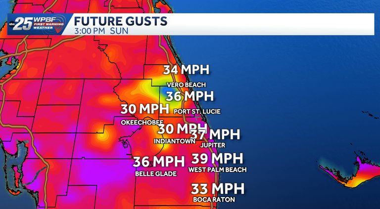
The WPBF 25 First Warning Weather Team has designated Sunday through Tuesday as Impact Weather days for the Palm Beaches and Treasure Coast. Meteorologist Nikki Sheaks reported that residents should prepare for strong winds, with gusts ranging from 30 to 40 mph, and scattered rain over the next two days.
Sunday outlook
Temperatures will be cooler on Sunday, with high temperatures in the low 80s. Morning showers are expected to affect roughly half of the area, bringing scattered rain and thunderstorms. The rain chance drops to about 40% in the afternoon, and isolated showers may linger into the evening.
Monday outlook
Monday will remain cooler, with highs still in the low 80s. Wind gusts will increase, reaching around 40 mph, making it the windiest day of the period. Isolated rain and thunderstorms are possible throughout the day.
Tuesday and beyond
Impactful winds are expected to ease heading into Wednesday. Scattered to isolated rain and storms will continue through the week, with total rainfall of one to three inches possible, especially along the coast.
Residents are encouraged to stay informed through the WPBF 25 News app, which provides real‑time updates and safety tips. Secure loose outdoor items, drive cautiously in gusty conditions, and plan indoor activities when possible.
Original reporting: WPBF (Treasure Coast / Hearst) — read the source article.