ALBUQUERQUE — The headline and opening lines point to a week of variable conditions: scattered showers and thunderstorms are possible early in the week, but most of those storms will likely produce virga or be dry thunderstorms rather than significant rainfall. Temperatures will trend a bit warmer than normal, with stronger winds expected by mid-week as a deep low-pressure system approaches the western U.S.
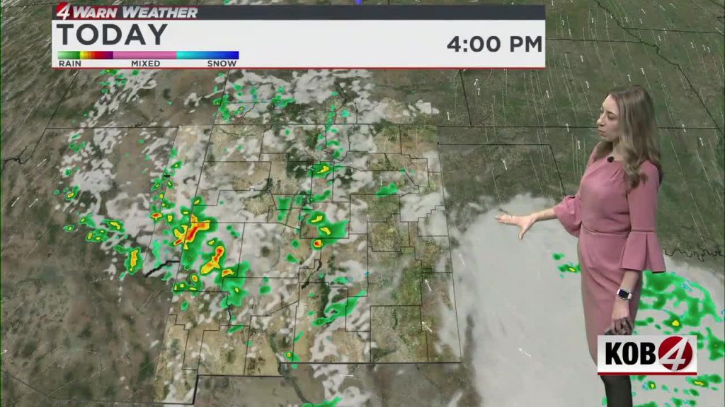
Monday will see spotty activity across New Mexico. Much of the rain that does form is expected to evaporate before reaching the ground (virga), and some storms could generate lightning without producing measurable precipitation at the surface. That combination—dry air with lightning—can raise concerns about new fire starts, especially in drier areas.
Daytime highs on Monday will be slightly above average for this time of year. Most communities should reach the 70s, a few lower-elevation locations could climb into the low 80s, and higher terrain will remain noticeably cooler. Overnight readings will stay mild compared with seasonal norms.
Tuesday will carry a similar chance for showers and isolated storms, but the broader pattern will trend warmer and breezier. Wind gusts are expected to increase, and areas that saw only virga on Monday could still experience gusty conditions and occasional lightning on Tuesday.
By mid-week, a strong low-pressure system moving into the West will tighten pressure gradients across the Desert Southwest, leading to heightened winds Wednesday and Thursday. The Albuquerque metro and surrounding valleys are likely to see the strongest gusts. Expect blowing dust in exposed areas, difficult travel in high-profile vehicles, and increased fire-weather concerns if dry thunderstorms produce lightning strikes without much rainfall.
Plan ahead: secure loose outdoor items, give yourself extra time for travel during windy periods, and avoid outdoor burning while lightning and dry fuels are possible. Keep an eye on local forecasts and weather alerts for the latest timing and any advisories as conditions evolve.


